
 1The Slow Town2Swartvlei3Groenvlei4Myoli Beach5Gericke's Point6The markets7Goukamma Reserve8Karatara91011Sedgefield 1
Sedgefield
The Slow Town between the lakes
Map data © OpenStreetMap contributors
4Right 4, opensAbout the place
About Sedgefield
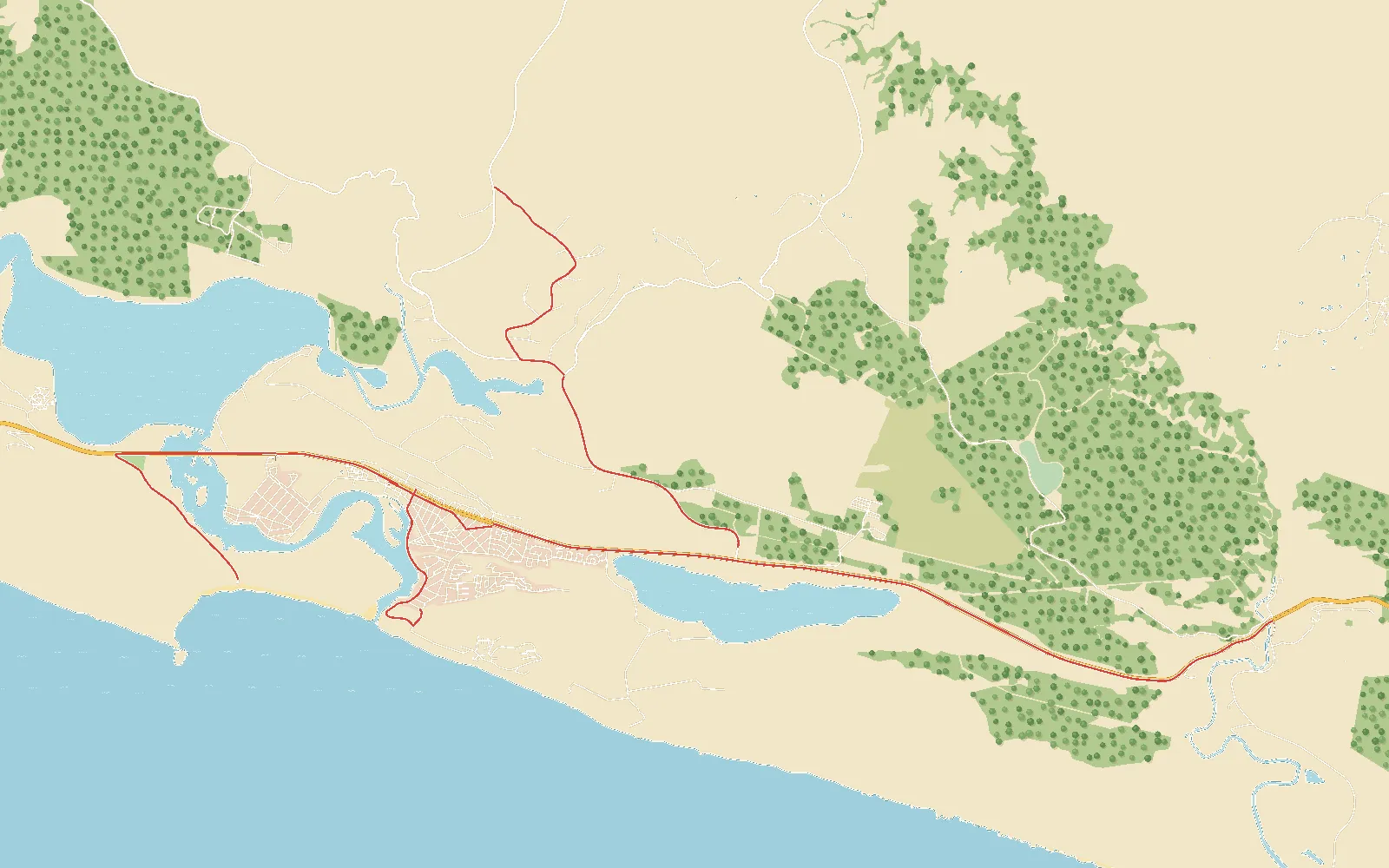
Sedgefield is the Slow Town: a village between the Swartvlei and Groenvlei lakes, west of Knysna on the N2, known for its mosaics and its Saturday markets.
The roads go round the lagoon, down to Myoli Beach, along the N2 past the lakes, and up into the plantations on Yellowwood Avenue, the area's gravel.
- Roads
- 9
- Road to drive
- 34 km
- Gravel
- 5 km
- Highest point
- 170 m
- Places to see
- 11
3Left 3, keep inPlaces to see
Places to see in Sedgefield
- 1
The Slow Town
Sedgefield was the first town in Africa to join Cittaslow, the slow-town movement: take your time, and enjoy the place.
- 2
Swartvlei
A big lake behind the dunes, joined to the sea by an estuary whose mouth opens and closes with the seasons.
- 3
Groenvlei
A freshwater lake in the Goukamma reserve with no river in or out: rain and springs keep it full.
- 4
Myoli Beach
Sedgefield's beach, at the bottom of Kingfisher Drive: dunes, rock pools and a long walk on the sand.
- 5
Gericke's Point
A rocky point on the beach west of town, reached on foot along the sand.
- 6
The markets
Saturday mornings, at the west end of town on the N2: Mosaic Village and the Wild Oats farmers' market.
- 7
Goukamma Reserve
Wild coast, dunes, fynbos and milkwood between Buffalo Bay and Sedgefield.
- 8
Karatara
A forestry village in the hills above Sedgefield, at the end of the gravel.
- 9
Sparkle of Myoli
A glittering mosaic Knysna seahorse, Nellie to the locals, standing in an old fishing boat from Gericke's Point at the foot of the dune to Myoli Beach. Her starfish steps have old fishing sinkers inside.
- 10
The Marinara
A big mosaic fish keeping watch over the lagoon mouth, words and symbols hidden in its tiles. Made for the Slow Festival in 2011, and rebuilt sturdier the year after.
- 11
Sedgefield 1
A whole little car covered in mosaic flowers by the town's mosaic makers, at the slipway on Kingfisher Drive. Climb in for a photo.
5Right 5, longWhere you drive
The roads
Barrington Link Road
North off the N2 between the lakes, up Barrington Link Road into the forestry hills.
Kingfisher Drive
From the village down Kingfisher Drive, through the holiday houses and the dune forest, to Myoli Beach.
N2: Goukamma
West on the N2 from the Buffalo Bay turn-off, along the Goukamma reserve's hills of fynbos and milkwood, to the picnic spot.
N2: Groenvlei
On west past Groenvlei, the lake with no river in or out, to the turn-off into Sedgefield.
N2: To the Markets
From the village west on the N2, past the Swartvlei turn-offs, to the Saturday markets at Mosaic Village and Wild Oats.
Round the Lagoon
Slowly round the lagoon's edge: down past the dune to Myoli Beach, along Leervis Road to the mouth, then up Kingfisher Drive beside the water, past the slipway. Three mosaics to find on the way.
Sedgefield Village
Off the N2 into the Slow Town: Pelican Avenue, Parakiet Road and the service road along the shops to the village centre.
Over the Bridge
From the markets on along the N2, west over the long low bridge across the Swartvlei estuary, then round and back down the far shore to the car park above Swartvlei Beach, across the mouth from Myoli.
Yellowwood Avenue
Gravel through the plantations and old forest above Sedgefield, along Yellowwood Avenue toward Karatara, the old woodcutters' village.